GODZILLA..BLIZZARD WARNING NYC METRO
+16
Quietace
RJB8525
LBC1985
skinsfan1177
amugs
SNOW MAN
rb924119
aiannone
Noreaster
Snow88
CPcantmeasuresnow
Math23x7
NjWeatherGuy
Radz
sroc4
Frank_Wx
20 posters
Page 2 of 5 •  1, 2, 3, 4, 5
 Re: GODZILLA..BLIZZARD WARNING NYC METRO
Im going to set the table here. Here is what we have to look for in order for this thing to really happen. Hr 54 from today's GFS 12z run.
https://2img.net/r/ihimizer/img715/1493/feb8th.png
The table is set nicely. What we need to pay particular attention to here is the HP to our north. IMO it is key. If it remains strong it remains stubborn and forces the northern energy south into the southern energy triggering the phase. Just how strong and how stubborn it will be will dictate when and how strong the phase will be. Notice there is also a 50/50 Low (approx 50n Lat and 50N Long) at this time frame. The stronger the phase the more the cold air can be drawn into the system esp into the upper atmosphere of the storm. If the phase is not as strong, or a little late the southern energy will have a chance to start intensifying as it reaches the warm Atlantic moisture coming from the gulf stream...very warm and will incorporate into the upper levels and slop fest for I95 and maybe even further west than that. However if the HP stays strong and the northern energy is allowed to trigger the initial strengthening then its colder air will work into the system. Now look at hr 78.
https://2img.net/r/ihimizer/img11/5232/feb8thsurfacehr78.png
The HP is building in behind the rapidly intensifying coastal. How strong the HP remains to the north as well as how strong its builds in behind is also vital to how strong she gets, when, and how much cold air is involved and at what levels of the atmosphere. The combination of the timing of the northern energy being injected into the southern energy as well as how steep the gradient is from HP to LP both to the north and to the west of the system will be vital.
Just for the record I still think that a late phase and only minor implications from this system is a possibility. If that 50/50 low is not as intense as it is shown at hr 54 or it is positioned further east will the HP to our north break down and move out too quickly which in turn allows the northern energy to escape to far to the north triggering the once again dreaded late phase OTS? That soln has been slowly deteriorating in my mind, but still not out of the question. Trust me I am ready to eat my crow, but will wait to take the first bite until Sat morning.
sroc4- Admin

- Posts : 8331
Join date : 2013-01-07
 Re: GODZILLA..BLIZZARD WARNING NYC METRO
After a long hiatus due to frustration, I'm back. The trend this winter is to have a lack luster southern stream and an overmodeled northern stream which ends up weaker by the time we get within 48 hrs or a "storm". With this set up with have a nice phase of these 2 streams taking place on some of our model guidance. I am cautiously optomisitc that we see a miracle (snow storm) considering the near neutral pna, ao and nao. Our pattern has been and still is so progressive that its hard to believe we could see a decent costal low develop. Ill take whatever snow falls from this storm. A lot can change. And the trends this winter r not our friend. Im rooting hard for a Euro type solution to this but I will remain objective. I would add more but it looks like u guys already did a good job.
Noreaster- Posts : 463
Join date : 2013-01-08
 Re: GODZILLA..BLIZZARD WARNING NYC METRO
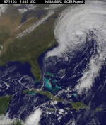
Idk if this was mentioned, but u all better be rooting for dynamic coooling, especially those SE of NYC otherwise this is a rain/slop fest even with a benchmark track in this garbage of a winter.
Noreaster- Posts : 463
Reputation : 5
Join date : 2013-01-08
Age : 41
Location : Merrick, NY
 Re: GODZILLA..BLIZZARD WARNING NYC METRO
I'm really trying to be optimistic but I really don't see the pattern supporting this type of storm. Maybe NE will get lucky. If the Euro still shows a similar set up at 12z 2mor I'll be in.

Noreaster- Posts : 463
Reputation : 5
Join date : 2013-01-08
Age : 41
Location : Merrick, NY
 Re: GODZILLA..BLIZZARD WARNING NYC METRO
I have had a lot of school work this week so its been hard for me to study the models, so after a quick look at them I made an impact map based on my thoughts. Does it need tweaking, i'm sure it does and thats why I want your comments because like I said I couldn't put much time in into it. Tomorrow I will make a final impact map or first call map depending on my confidence and then Thursday or Thursday night i will release a final call map. Enjoy!


_________________
-Alex Iannone-

aiannone- Senior Enthusiast - Mod

- Posts : 4813
Reputation : 92
Join date : 2013-01-07
Location : Saint James, LI (Northwest Suffolk Co.)
 Re: GODZILLA..BLIZZARD WARNING NYC METRO
I told you on facebook Alex but I will say it again, I like your map but would extend moderate accumulations back into PA and WNY. Now everyone into the chat!!!
 Re: GODZILLA..BLIZZARD WARNING NYC METRO
The 00z EURO went ballistic tonight!!!!!!
About 12-18 inches of snow for us in NYC Metro area. 24+ inches for Boston!!! WOW
About 12-18 inches of snow for us in NYC Metro area. 24+ inches for Boston!!! WOW
 Re: GODZILLA..BLIZZARD WARNING NYC METRO
H5 on the Euro closes off near Maryland

Snow88- Senior Enthusiast

- Posts : 2193
Reputation : 4
Join date : 2013-01-09
Age : 35
Location : Brooklyn, NY
 Re: GODZILLA..BLIZZARD WARNING NYC METRO
Li looked jackpotted on that run. It was insane...well for our area. Boston get destroyed.

Noreaster- Posts : 463
Reputation : 5
Join date : 2013-01-08
Age : 41
Location : Merrick, NY
 Re: GODZILLA..BLIZZARD WARNING NYC METRO
I wish I could post what i just saw on wunderground. Area of 1-2 ft near nyc and 24+ on LI

Noreaster- Posts : 463
Reputation : 5
Join date : 2013-01-08
Age : 41
Location : Merrick, NY
 Re: GODZILLA..BLIZZARD WARNING NYC METRO
I just can't believe this is a possibility with how the pattern looks. But wooww!

Noreaster- Posts : 463
Reputation : 5
Join date : 2013-01-08
Age : 41
Location : Merrick, NY
 Re: GODZILLA..BLIZZARD WARNING NYC METRO
go to 72 hrs since i cant paste on here for some reason
http://www.meteo.psu.edu/~fxg1/ECMWF_0z/ecmwfloop.html#picture
Crazy
http://vortex.plymouth.edu/cgi-bin/gen_grb-comp2.cgi?re=us&mo=ecmwf&va=csfcpr&ft=h72&cu=latest&ge=800x630&id=&zoom=.6
http://www.meteo.psu.edu/~fxg1/ECMWF_0z/ecmwfloop.html#picture
Crazy
http://vortex.plymouth.edu/cgi-bin/gen_grb-comp2.cgi?re=us&mo=ecmwf&va=csfcpr&ft=h72&cu=latest&ge=800x630&id=&zoom=.6

Noreaster- Posts : 463
Reputation : 5
Join date : 2013-01-08
Age : 41
Location : Merrick, NY
 Re: GODZILLA..BLIZZARD WARNING NYC METRO
Hey guys, sorry I'm so late to the party but I haven't been following at all because there has been nothing to track. I went to the other board and saw that y'all came over this way......I couldn't help but follow. Let's get tracking baby!!
rb924119- Meteorologist

- Posts : 6889
Reputation : 194
Join date : 2013-02-06
Age : 32
Location : Greentown, Pa
 Re: GODZILLA..BLIZZARD WARNING NYC METRO
Hey rb welcome over here man. This just in from JB this morning.
Quote
The colder run means that heavier accumulations will be further south and west and the NYC to Boston corridor is in line for the heaviest with alot of this area getting 1-2 feet of snow, even with rain mixing in on the coast. ECMWF/ JMA blend is closest to my thinking, and this means a crippling event for much of the area from N Jersey through southern and central New England. Near hurricane force winds can develop in coastal areas. The storm will be extensive north of I 70 in the midwest with the I80 corridor Chicago to Pa seeing more than 4 inches and a band of 8-12 inches Michigan into New York State. The southwest side of snow accumualtions of more than 3 inches cold reach as for south as BWI to ACY with this
Keep in mind that great storms draw all air masses toward them, so while warming is rushing to the center, so is cooling... and the tightening of the baroclinic ribbon deepens the storm explosively and allows rain to turn back to snow quickly . So there may be places that see rain for a few hours, that wind up with as much or more than a place that was snowing the entire storm. This has the chance to have bands of 3-5 inches and hour, and those would be close to where the rain/snow line is
_________________
"In weather and in life, there's no winning and losing; there's only winning and learning."
WINTER 2012/2013 TOTALS 43.65"WINTER 2017/2018 TOTALS 62.85" WINTER 2022/2023 TOTALS 4.9"
WINTER 2013/2014 TOTALS 64.85"WINTER 2018/2019 TOTALS 14.25" WINTER 2023/2024 TOTALS 13.1"
WINTER 2014/2015 TOTALS 71.20"WINTER 2019/2020 TOTALS 6.35"
WINTER 2015/2016 TOTALS 35.00"WINTER 2020/2021 TOTALS 37.75"
WINTER 2016/2017 TOTALS 42.25"WINTER 2021/2022 TOTALS 31.65"

sroc4- Admin

- Posts : 8331
Reputation : 301
Join date : 2013-01-07
Location : Wading River, LI
 Re: GODZILLA..BLIZZARD WARNING NYC METRO
Does anyone have an idea what Eastern Pa. will get for snow totals with this storm. I hoping for a nice BIG WALLOP ! I would love to have the day off and not have to commute into N.J.

SNOW MAN- Senior Enthusiast

- Posts : 1361
Reputation : 25
Join date : 2013-01-13
Age : 64
Location : Marshalls Creek Pa.
 Re: GODZILLA..BLIZZARD WARNING NYC METRO
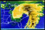
Wow, the 0Z Euro was amazing... GFS late phase but wrap around... NAM phases too late. Looking fwd to todays 12Z suite!!
Radz- Pro Enthusiast

- Posts : 1028
Reputation : 17
Join date : 2013-01-12
Location : Cortlandt Manor NY
 Re: GODZILLA..BLIZZARD WARNING NYC METRO
Noreaster wrote:I just can't believe this is a possibility with how the pattern looks. But wooww!
Hey Ryan Im with you on this. There was just no way I was buying into this, but Jesus yet another 24hrs of agreement; although the NAM is still an OTS late phase outlier. But man that Euro is so stubborn. If this storm actually happens here is my theory why.
The PNA is neg and will be slight neg or around neutral at the time of this storm. Typically not strong enough of a ridge in the west to tip the northern energy allowing what the models show for this storm. The NAO has been slight positive and is forecast to be slight pos or neutral. So how does that help? Well if you actually look at the east based NAO it has been predicted to be neg where as the West based NAO has been predicted to be pos. This to me tells be that there is a ridge in the north atlantic it is just too far east. This should create a progressive flow along the eastcoast with this type of setup. If you recall the image from last Sundays storm where the phase occurs too late before the phased storm heads north. https://2img.net/r/ihimizer/img41/4456/soclosex.png
Well this storm looks to be different. Why. Well first notice in the image from last Sunday there is no HP to our north. With this set up there is a strong HP (approx 1037-1040MB) to the north that is forcing the northern energy south. So why isnt it just moving out in the progressive pattern? Well if you recall there has been wave after wave of clippers through the area. Well look as the two systems approach the east coast as they are about to phase...look at the bottle neck to the north and east. Every one of the LP are sub 1000mb with that strong ridge in the eastern atlantic.
https://2img.net/r/ihimizer/img594/5154/bottleneck.png
The HP to our north is still key to the phase here, but it only establishes itself like it does because of the bottle neck to its north and east IMO.
_________________
"In weather and in life, there's no winning and losing; there's only winning and learning."
WINTER 2012/2013 TOTALS 43.65"WINTER 2017/2018 TOTALS 62.85" WINTER 2022/2023 TOTALS 4.9"
WINTER 2013/2014 TOTALS 64.85"WINTER 2018/2019 TOTALS 14.25" WINTER 2023/2024 TOTALS 13.1"
WINTER 2014/2015 TOTALS 71.20"WINTER 2019/2020 TOTALS 6.35"
WINTER 2015/2016 TOTALS 35.00"WINTER 2020/2021 TOTALS 37.75"
WINTER 2016/2017 TOTALS 42.25"WINTER 2021/2022 TOTALS 31.65"

sroc4- Admin

- Posts : 8331
Reputation : 301
Join date : 2013-01-07
Location : Wading River, LI
 Re: GODZILLA..BLIZZARD WARNING NYC METRO
And the NAM caves...all major models show a coastal. No its time to nail down a track and who gets what
_________________
"In weather and in life, there's no winning and losing; there's only winning and learning."
WINTER 2012/2013 TOTALS 43.65"WINTER 2017/2018 TOTALS 62.85" WINTER 2022/2023 TOTALS 4.9"
WINTER 2013/2014 TOTALS 64.85"WINTER 2018/2019 TOTALS 14.25" WINTER 2023/2024 TOTALS 13.1"
WINTER 2014/2015 TOTALS 71.20"WINTER 2019/2020 TOTALS 6.35"
WINTER 2015/2016 TOTALS 35.00"WINTER 2020/2021 TOTALS 37.75"
WINTER 2016/2017 TOTALS 42.25"WINTER 2021/2022 TOTALS 31.65"

sroc4- Admin

- Posts : 8331
Reputation : 301
Join date : 2013-01-07
Location : Wading River, LI
 Re: GODZILLA..BLIZZARD WARNING NYC METRO
NAM is a huge step toward the EURO. I can not wait for the 12 GFS
 Re: GODZILLA..BLIZZARD WARNING NYC METRO
One thing to note too I think is the deep trough coming into the west coast. I don't know if it is just me, but as that thing slides east it helps to build in a "better" ridge out ahead of it behind the northern stream shortwave. Because of this, the shortwave acquires more curvature, more vorticity and helps to strengthen cyclogenesis there. Because the wave itself is stronger, it also helps to carve out the trough so that as it moves east it can actually capture the southern stream energy. I personally feel that is another key ingredient because if that shortwave trough comes up weak.......it just rides its way outta town. What do you think?
rb924119- Meteorologist

- Posts : 6889
Reputation : 194
Join date : 2013-02-06
Age : 32
Location : Greentown, Pa
 Re: GODZILLA..BLIZZARD WARNING NYC METRO
rb924119 wrote:One thing to note too I think is the deep trough coming into the west coast. I don't know if it is just me, but as that thing slides east it helps to build in a "better" ridge out ahead of it behind the northern stream shortwave. Because of this, the shortwave acquires more curvature, more vorticity and helps to strengthen cyclogenesis there. Because the wave itself is stronger, it also helps to carve out the trough so that as it moves east it can actually capture the southern stream energy. I personally feel that is another key ingredient because if that shortwave trough comes up weak.......it just rides its way outta town. What do you think?
I agree. Looking at water vapor maps, the northern stream energy already looks strong. Tomorrow, we should start seeing how well it's digging into the ridge.
By the way, the 12z NAM gives Boston 50+ inches of snow
 Re: GODZILLA..BLIZZARD WARNING NYC METRO
The 12z GFS is rain to snow but it made big steps toward the EURO at the h5 level. There is a huge deform band that brings heavy snow to the area. The american models are still trying to get a gauge of the streams involved.
 Re: GODZILLA..BLIZZARD WARNING NYC METRO
Frank,
What is the timing - Friday morning start??
NWS saying possible blizzard from CNJ up to Maine.
Mugs
What is the timing - Friday morning start??
NWS saying possible blizzard from CNJ up to Maine.
Mugs

amugs- Advanced Forecaster - Mod

- Posts : 15093
Reputation : 213
Join date : 2013-01-07
Age : 54
Location : Hillsdale,NJ
 Re: GODZILLA..BLIZZARD WARNING NYC METRO
amugs wrote:Frank,
What is the timing - Friday morning start??
NWS saying possible blizzard from CNJ up to Maine.
Mugs
Friday morning, between 8 and 11am. Should end early Saturday morning, maybe 7am.
 Re: GODZILLA..BLIZZARD WARNING NYC METRO
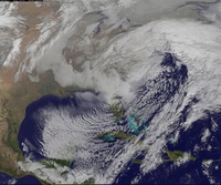
Im worried about rain, this coastal needs to form a little bit earlier because the surface temps are looking warm on the models, probably because of a torch from the primary low.
NjWeatherGuy- Advanced Forecaster

- Posts : 4100
Reputation : 28
Join date : 2013-01-06
Location : Belle Mead, NJ
 Re: GODZILLA..BLIZZARD WARNING NYC METRO
1st guess snow map and synopsis from EPAWA
http://epawablogs.com/wx-alert-maps/
http://epawablogs.com/wx-alert-maps/
Page 2 of 5 •  1, 2, 3, 4, 5
Permissions in this forum:
You cannot reply to topics in this forum
 Home
Home