
 Search
2017 General Tropical Cyclone Discussion Thread
Page 3 of 40 •  1, 2, 3, 4 ... 21 ... 40
 ![]()
Re: 2017 General Tropical Cyclone Discussion Thread
![]() by sroc4 Mon Jul 10, 2017 6:12 pm
by sroc4 Mon Jul 10, 2017 6:12 pm
jmanley32 wrote:People on other chats seem to feel x t 4 might become something. It's def not gone but nhc doesn't think so.
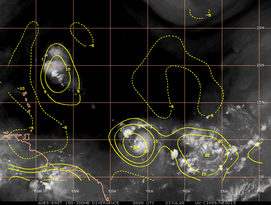
I doubt it. Although there is decent upper level divergence and low level convergence the ULL spinning to its north is creating a significant amount of shear in the N and NW quadrants. In addition it may be ingesting dry air from the west. The vorticity is very spread out and not focused at all. Maybe if it gets into the GOM it may have a chance.


sroc4- Admin

- Posts : 8331
Join date : 2013-01-07
Re: 2017 General Tropical Cyclone Discussion Thread
![]() by jmanley32 Mon Jul 10, 2017 9:40 pm
by jmanley32 Mon Jul 10, 2017 9:40 pm
jmanley32- Senior Enthusiast

- Posts : 20513
Join date : 2013-12-12
Bermuda
![]() by dkodgis Tue Jul 11, 2017 3:35 pm
by dkodgis Tue Jul 11, 2017 3:35 pm

dkodgis- Senior Enthusiast
- Posts : 2498
Reputation : 98
Join date : 2013-12-29
Re: 2017 General Tropical Cyclone Discussion Thread
![]() by jmanley32 Tue Jul 11, 2017 11:30 pm
by jmanley32 Tue Jul 11, 2017 11:30 pm

jmanley32- Senior Enthusiast
- Posts : 20513
Reputation : 108
Join date : 2013-12-12
Age : 42
Location : Yonkers, NY
Re: 2017 General Tropical Cyclone Discussion Thread
![]() by sroc4 Wed Jul 12, 2017 12:46 pm
by sroc4 Wed Jul 12, 2017 12:46 pm
but I would like to pose the following questions for you all to think on, as I already have my own personal views on the subject: Given this season's tendencies for troughing in the eastern CONUS and the incredibly below average SSTs off the Mid-Atlantic and New England coasts, what impacts could those have on the brilliant list of factors mentioned above? Also something to consider, given the MJO projections as stated in coordination with the atmospheric projection of a weakly warm ENSO state basis the SOI, how could those impact the overall development of the system in question?
Specifically what would happen to a Trop system approaching the EC with the large scale propensity to have troughs come and go into the NE. My initial reaction would be one that would come down to timing. With a predominately +NAO I cant imagine anything but transient positively tilted trough orientation such that re curvature being most likely if the trop system was approaching from the east the same time the trough was approaching from the west. However, if the trop system arrived as the trough was lifting out we would have to watch how strong the ridging builds back in and where the weakness would be making a possible EC hit very likely. Given the way the MJO and SOI projections are looking the "ridge" over troubled waters will have to be watched closely throughout August and Sept.
_________________
"In weather and in life, there's no winning and losing; there's only winning and learning."
WINTER 2012/2013 TOTALS 43.65"WINTER 2017/2018 TOTALS 62.85" WINTER 2022/2023 TOTALS 4.9"
WINTER 2013/2014 TOTALS 64.85"WINTER 2018/2019 TOTALS 14.25" WINTER 2023/2024 TOTALS 13.1"
WINTER 2014/2015 TOTALS 71.20"WINTER 2019/2020 TOTALS 6.35"
WINTER 2015/2016 TOTALS 35.00"WINTER 2020/2021 TOTALS 37.75"
WINTER 2016/2017 TOTALS 42.25"WINTER 2021/2022 TOTALS 31.65"

sroc4- Admin
- Posts : 8331
Reputation : 301
Join date : 2013-01-07
Location : Wading River, LI
Re: 2017 General Tropical Cyclone Discussion Thread
![]() by jmanley32 Wed Jul 12, 2017 2:06 pm
by jmanley32 Wed Jul 12, 2017 2:06 pm
sroc4 wrote:Thanks Jman. The exact reason why Trop systems must be looked at in 3-5day increments and no further; esp when the system hasnt actually formed yet. And Ray I have been pondering your questions from a few days ago.
but I would like to pose the following questions for you all to think on, as I already have my own personal views on the subject: Given this season's tendencies for troughing in the eastern CONUS and the incredibly below average SSTs off the Mid-Atlantic and New England coasts, what impacts could those have on the brilliant list of factors mentioned above? Also something to consider, given the MJO projections as stated in coordination with the atmospheric projection of a weakly warm ENSO state basis the SOI, how could those impact the overall development of the system in question?
Specifically what would happen to a Trop system approaching the EC with the large scale propensity to have troughs come and go into the NE. My initial reaction would be one that would come down to timing. With a predominately +NAO I cant imagine anything but transient positively tilted trough orientation such that re curvature being most likely if the trop system was approaching from the east the same time the trough was approaching from the west. However, if the trop system arrived as the trough was lifting out we would have to watch how strong the ridging builds back in and where the weakness would be making a possible EC hit very likely. Given the way the MJO and SOI projections are looking the "ridge" over troubled waters will have to be watched closely throughout August and Sept.
I agree there is a good chance troughs could push it OTS but if timing is right we or somewhere on the EC could be in trouble. I noted recently the waters up here have been quite cold, that would inhibit any rapid strengthening the further north any system gets, what is the projection for the waters going into Aug, Sept. Oct?
jmanley32- Senior Enthusiast
- Posts : 20513
Reputation : 108
Join date : 2013-12-12
Age : 42
Location : Yonkers, NY
Re: 2017 General Tropical Cyclone Discussion Thread
![]() by jmanley32 Sat Jul 15, 2017 5:59 pm
by jmanley32 Sat Jul 15, 2017 5:59 pm
jmanley32- Senior Enthusiast
- Posts : 20513
Reputation : 108
Join date : 2013-12-12
Age : 42
Location : Yonkers, NY
Re: 2017 General Tropical Cyclone Discussion Thread
![]() by jmanley32 Sat Jul 15, 2017 9:25 pm
by jmanley32 Sat Jul 15, 2017 9:25 pm
jmanley32- Senior Enthusiast
- Posts : 20513
Reputation : 108
Join date : 2013-12-12
Age : 42
Location : Yonkers, NY
Re: 2017 General Tropical Cyclone Discussion Thread
![]() by amugs Mon Jul 17, 2017 10:15 am
by amugs Mon Jul 17, 2017 10:15 am
_________________
Mugs
AKA:King: Snow Weenie
Self Proclaimed
WINTER 2014-15 : 55.12" +.02 for 6 coatings (avg. 35")
WINTER 2015-16 Total - 29.8" (Avg 35")
WINTER 2016-17 : 39.5" so far

amugs- Advanced Forecaster - Mod

- Posts : 15093
Reputation : 213
Join date : 2013-01-07
Age : 54
Location : Hillsdale,NJ
Re: 2017 General Tropical Cyclone Discussion Thread
![]() by jmanley32 Mon Jul 17, 2017 7:06 pm
by jmanley32 Mon Jul 17, 2017 7:06 pm
Don is very low and looks to hit skim south america
jmanley32- Senior Enthusiast
- Posts : 20513
Reputation : 108
Join date : 2013-12-12
Age : 42
Location : Yonkers, NY
Re: 2017 General Tropical Cyclone Discussion Thread
![]() by sroc4 Tue Jul 18, 2017 1:53 pm
by sroc4 Tue Jul 18, 2017 1:53 pm
jmanley32 wrote:Well don was able to develop and nhc has highlighted a new area
Don is very low and looks to hit skim south america
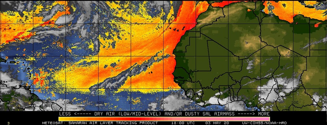
Ehh. Recon showed weakening today. You can clearly see the northern periphery of the system is being sheared on visible satellite.

When looking at lower level winds you can see that they begin to accelerate when you look at the Caribbean between approx. 62*W and 70*W. This will lead to low level divergence (NOT conducive to convection).

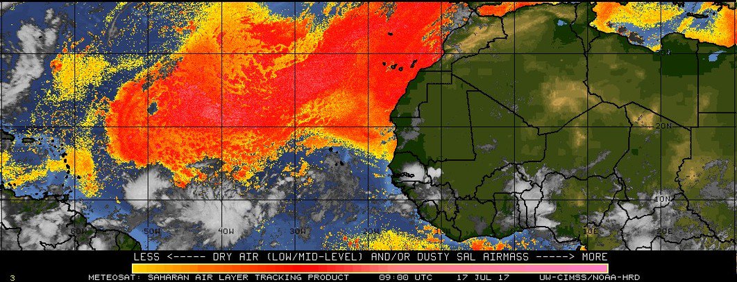
The dry air is intense to its immediate N. and although the LLC of circulation has been relatively protected from it thus far, allowing it to develop in the first place, it appears that some of the dry air and the SAL is mixing in at the mid levels. This system is likely Don for(see what I did there). Grenada and some of the other S islands in the chain will experience trop storm conditions, but this system is a big yawn for me.


_________________
"In weather and in life, there's no winning and losing; there's only winning and learning."
WINTER 2012/2013 TOTALS 43.65"WINTER 2017/2018 TOTALS 62.85" WINTER 2022/2023 TOTALS 4.9"
WINTER 2013/2014 TOTALS 64.85"WINTER 2018/2019 TOTALS 14.25" WINTER 2023/2024 TOTALS 13.1"
WINTER 2014/2015 TOTALS 71.20"WINTER 2019/2020 TOTALS 6.35"
WINTER 2015/2016 TOTALS 35.00"WINTER 2020/2021 TOTALS 37.75"
WINTER 2016/2017 TOTALS 42.25"WINTER 2021/2022 TOTALS 31.65"
sroc4- Admin
- Posts : 8331
Reputation : 301
Join date : 2013-01-07
Location : Wading River, LI
Re: 2017 General Tropical Cyclone Discussion Thread
![]() by jmanley32 Tue Jul 18, 2017 3:53 pm
by jmanley32 Tue Jul 18, 2017 3:53 pm
jmanley32- Senior Enthusiast
- Posts : 20513
Reputation : 108
Join date : 2013-12-12
Age : 42
Location : Yonkers, NY
Re: 2017 General Tropical Cyclone Discussion Thread
![]() by amugs Fri Jul 21, 2017 8:20 am
by amugs Fri Jul 21, 2017 8:20 am

_________________
Mugs
AKA:King: Snow Weenie
Self Proclaimed
WINTER 2014-15 : 55.12" +.02 for 6 coatings (avg. 35")
WINTER 2015-16 Total - 29.8" (Avg 35")
WINTER 2016-17 : 39.5" so far
amugs- Advanced Forecaster - Mod
- Posts : 15093
Reputation : 213
Join date : 2013-01-07
Age : 54
Location : Hillsdale,NJ
Re: 2017 General Tropical Cyclone Discussion Thread
![]() by sroc4 Fri Jul 21, 2017 2:42 pm
by sroc4 Fri Jul 21, 2017 2:42 pm
amugs wrote:Put a fork in July!!
There is still a very active African wave train. I would still keep an eye on the wave coming off the coast now, but even more so the one in its wake at around 10*E. There will be still plenty of SAL to contend with, so development will be difficult, but not impossible given the prolonged positive SOI readings. Plus the SAL is forecast to dissipate some. Around this time frame the MSLP of the Atlantic HP is forecast to drop to the low 1020's on both GFS and Euro. I guess there really isnt much time left for any significant impacts to land in July, but I do think that the second wave coming off Africa has a decent chance. We shall see.

_________________
"In weather and in life, there's no winning and losing; there's only winning and learning."
WINTER 2012/2013 TOTALS 43.65"WINTER 2017/2018 TOTALS 62.85" WINTER 2022/2023 TOTALS 4.9"
WINTER 2013/2014 TOTALS 64.85"WINTER 2018/2019 TOTALS 14.25" WINTER 2023/2024 TOTALS 13.1"
WINTER 2014/2015 TOTALS 71.20"WINTER 2019/2020 TOTALS 6.35"
WINTER 2015/2016 TOTALS 35.00"WINTER 2020/2021 TOTALS 37.75"
WINTER 2016/2017 TOTALS 42.25"WINTER 2021/2022 TOTALS 31.65"
sroc4- Admin
- Posts : 8331
Reputation : 301
Join date : 2013-01-07
Location : Wading River, LI
Re: 2017 General Tropical Cyclone Discussion Thread
![]() by jmanley32 Fri Jul 21, 2017 4:34 pm
by jmanley32 Fri Jul 21, 2017 4:34 pm
jmanley32- Senior Enthusiast
- Posts : 20513
Reputation : 108
Join date : 2013-12-12
Age : 42
Location : Yonkers, NY
Re: 2017 General Tropical Cyclone Discussion Thread
![]() by amugs Sat Jul 22, 2017 2:00 pm
by amugs Sat Jul 22, 2017 2:00 pm
_________________
Mugs
AKA:King: Snow Weenie
Self Proclaimed
WINTER 2014-15 : 55.12" +.02 for 6 coatings (avg. 35")
WINTER 2015-16 Total - 29.8" (Avg 35")
WINTER 2016-17 : 39.5" so far
amugs- Advanced Forecaster - Mod
- Posts : 15093
Reputation : 213
Join date : 2013-01-07
Age : 54
Location : Hillsdale,NJ
Re: 2017 General Tropical Cyclone Discussion Thread
![]() by jmanley32 Mon Jul 24, 2017 4:04 pm
by jmanley32 Mon Jul 24, 2017 4:04 pm
jmanley32- Senior Enthusiast
- Posts : 20513
Reputation : 108
Join date : 2013-12-12
Age : 42
Location : Yonkers, NY
Re: 2017 General Tropical Cyclone Discussion Thread
![]() by jmanley32 Mon Jul 24, 2017 4:07 pm
by jmanley32 Mon Jul 24, 2017 4:07 pm
jmanley32- Senior Enthusiast
- Posts : 20513
Reputation : 108
Join date : 2013-12-12
Age : 42
Location : Yonkers, NY
Re: 2017 General Tropical Cyclone Discussion Thread
![]() by amugs Tue Jul 25, 2017 11:25 pm
by amugs Tue Jul 25, 2017 11:25 pm
_________________
Mugs
AKA:King: Snow Weenie
Self Proclaimed
WINTER 2014-15 : 55.12" +.02 for 6 coatings (avg. 35")
WINTER 2015-16 Total - 29.8" (Avg 35")
WINTER 2016-17 : 39.5" so far
amugs- Advanced Forecaster - Mod
- Posts : 15093
Reputation : 213
Join date : 2013-01-07
Age : 54
Location : Hillsdale,NJ
Re: 2017 General Tropical Cyclone Discussion Thread
![]() by sroc4 Wed Jul 26, 2017 2:37 pm
by sroc4 Wed Jul 26, 2017 2:37 pm
_________________
"In weather and in life, there's no winning and losing; there's only winning and learning."
WINTER 2012/2013 TOTALS 43.65"WINTER 2017/2018 TOTALS 62.85" WINTER 2022/2023 TOTALS 4.9"
WINTER 2013/2014 TOTALS 64.85"WINTER 2018/2019 TOTALS 14.25" WINTER 2023/2024 TOTALS 13.1"
WINTER 2014/2015 TOTALS 71.20"WINTER 2019/2020 TOTALS 6.35"
WINTER 2015/2016 TOTALS 35.00"WINTER 2020/2021 TOTALS 37.75"
WINTER 2016/2017 TOTALS 42.25"WINTER 2021/2022 TOTALS 31.65"
sroc4- Admin
- Posts : 8331
Reputation : 301
Join date : 2013-01-07
Location : Wading River, LI
Re: 2017 General Tropical Cyclone Discussion Thread
![]() by amugs Sat Jul 29, 2017 11:20 am
by amugs Sat Jul 29, 2017 11:20 am
_________________
Mugs
AKA:King: Snow Weenie
Self Proclaimed
WINTER 2014-15 : 55.12" +.02 for 6 coatings (avg. 35")
WINTER 2015-16 Total - 29.8" (Avg 35")
WINTER 2016-17 : 39.5" so far
amugs- Advanced Forecaster - Mod
- Posts : 15093
Reputation : 213
Join date : 2013-01-07
Age : 54
Location : Hillsdale,NJ
Re: 2017 General Tropical Cyclone Discussion Thread
![]() by amugs Sat Jul 29, 2017 11:18 pm
by amugs Sat Jul 29, 2017 11:18 pm

_________________
Mugs
AKA:King: Snow Weenie
Self Proclaimed
WINTER 2014-15 : 55.12" +.02 for 6 coatings (avg. 35")
WINTER 2015-16 Total - 29.8" (Avg 35")
WINTER 2016-17 : 39.5" so far
amugs- Advanced Forecaster - Mod
- Posts : 15093
Reputation : 213
Join date : 2013-01-07
Age : 54
Location : Hillsdale,NJ
Re: 2017 General Tropical Cyclone Discussion Thread
![]() by rb924119 Sun Jul 30, 2017 5:20 am
by rb924119 Sun Jul 30, 2017 5:20 am
rb924119- Meteorologist

- Posts : 6890
Reputation : 194
Join date : 2013-02-06
Age : 32
Location : Greentown, Pa
Re: 2017 General Tropical Cyclone Discussion Thread
![]() by sroc4 Sun Jul 30, 2017 5:51 pm
by sroc4 Sun Jul 30, 2017 5:51 pm
_________________
"In weather and in life, there's no winning and losing; there's only winning and learning."
WINTER 2012/2013 TOTALS 43.65"WINTER 2017/2018 TOTALS 62.85" WINTER 2022/2023 TOTALS 4.9"
WINTER 2013/2014 TOTALS 64.85"WINTER 2018/2019 TOTALS 14.25" WINTER 2023/2024 TOTALS 13.1"
WINTER 2014/2015 TOTALS 71.20"WINTER 2019/2020 TOTALS 6.35"
WINTER 2015/2016 TOTALS 35.00"WINTER 2020/2021 TOTALS 37.75"
WINTER 2016/2017 TOTALS 42.25"WINTER 2021/2022 TOTALS 31.65"
sroc4- Admin
- Posts : 8331
Reputation : 301
Join date : 2013-01-07
Location : Wading River, LI
Re: 2017 General Tropical Cyclone Discussion Thread
![]() by jmanley32 Sun Jul 30, 2017 6:49 pm
by jmanley32 Sun Jul 30, 2017 6:49 pm
jmanley32- Senior Enthusiast
- Posts : 20513
Reputation : 108
Join date : 2013-12-12
Age : 42
Location : Yonkers, NY
Re: 2017 General Tropical Cyclone Discussion Thread
![]() by jmanley32 Mon Jul 31, 2017 9:10 am
by jmanley32 Mon Jul 31, 2017 9:10 am
jmanley32- Senior Enthusiast
- Posts : 20513
Reputation : 108
Join date : 2013-12-12
Age : 42
Location : Yonkers, NY
Re: 2017 General Tropical Cyclone Discussion Thread
![]() by amugs Mon Jul 31, 2017 11:31 am
by amugs Mon Jul 31, 2017 11:31 am
She spun up real fast and thanks be that she is so close to land and not 500 miles out over the GOM!
There is another trough that is going to drop in later the week and if Emily is still spinning around the Carolinas she MAY feel the tug on tjis with higher pressures up over the Nefoundland region that could steer here uo towards NE. Could be interesting. Just puttimg it out there.
_________________
Mugs
AKA:King: Snow Weenie
Self Proclaimed
WINTER 2014-15 : 55.12" +.02 for 6 coatings (avg. 35")
WINTER 2015-16 Total - 29.8" (Avg 35")
WINTER 2016-17 : 39.5" so far
amugs- Advanced Forecaster - Mod
- Posts : 15093
Reputation : 213
Join date : 2013-01-07
Age : 54
Location : Hillsdale,NJ
Page 3 of 40 • 1, 2, 3, 4 ... 21 ... 40 ![]()
|
|
|